File list
This special page shows all uploaded files.
| Name | Thumbnail | Size | User | Description | Versions | |
|---|---|---|---|---|---|---|
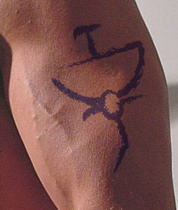
| 17:03, 22 May 2013 | Entangle.jpg (file) |  |
23 KB | W0ldianDM | Brahmah's Tattoo of Entangle Spell. | 1 |
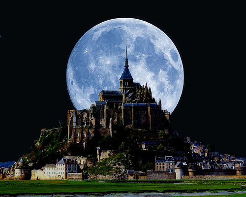
| 17:18, 10 March 2013 | Wayfarer.jpg (file) |  |
111 KB | W0ldianDM | 1 | |
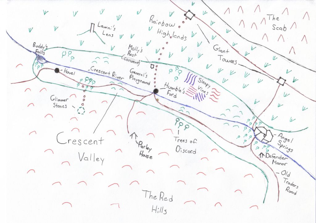
| 09:12, 10 March 2013 | Crescent Valley.jpg (file) |  |
85 KB | W0ldianDM | 1 | |
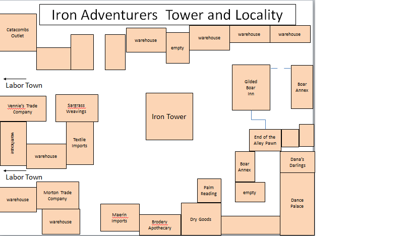
| 18:47, 8 January 2013 | Iron Tower Square.png (file) |  |
27 KB | W0ldianDM | 1 | |
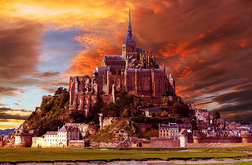
| 18:41, 8 January 2013 | Wayfarer City Image.jpg (file) |  |
158 KB | W0ldianDM | 1 | |
| 17:38, 16 September 2012 | PcMemorial quarter.png (file) |  |
113 KB | W0ldianDM | 1 | |
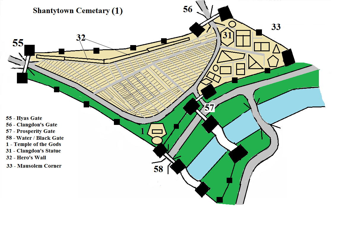
| 17:35, 16 September 2012 | Pcshantytown.png (file) |  |
113 KB | W0ldianDM | 1 | |
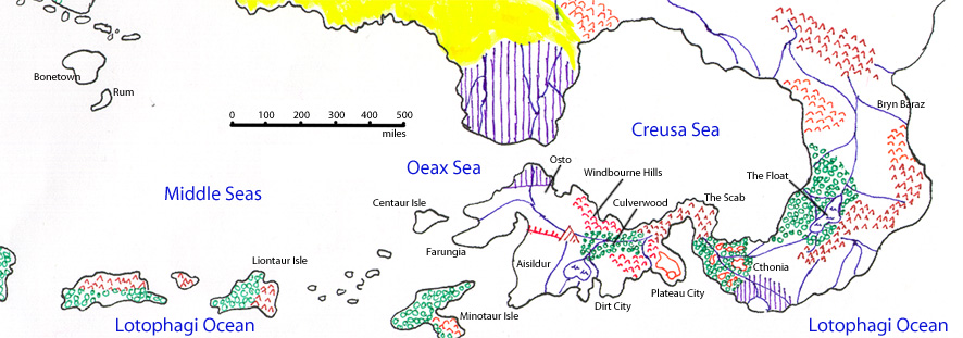
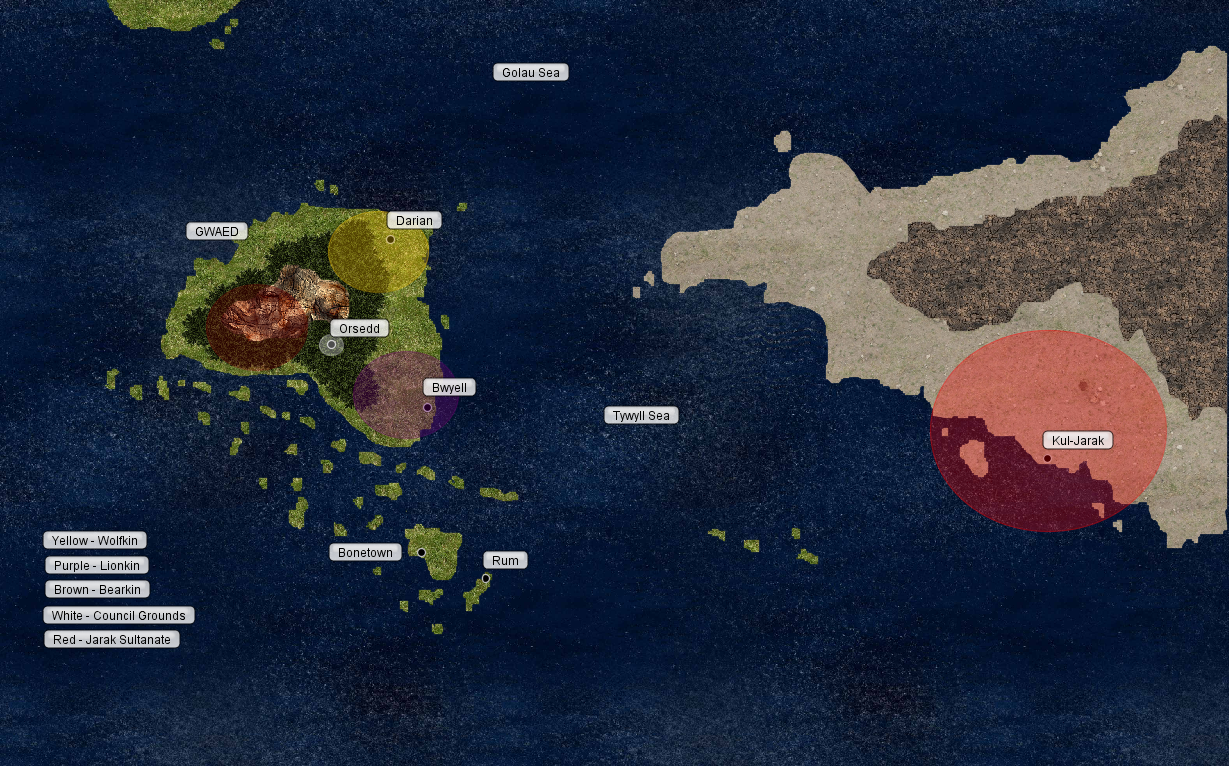
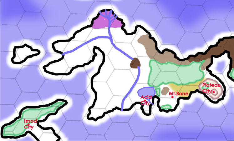
| 05:51, 8 April 2012 | Southern-Yrth-8Apr12.jpg (file) |  |
125 KB | Cayzle | A map of the southern portion of the Continent of Yrth, showing those lands in which the civilization of New Elenna has spread, from Bonetown in the west to Brynn Baraz in the east. A scale showing miles in hundreds is included, with a selection of locati | 1 |
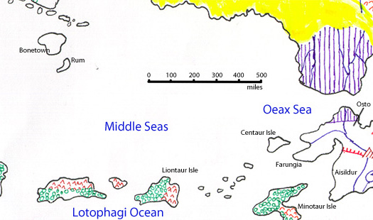
| 05:49, 8 April 2012 | Middle-Seas-8Apr12.jpg (file) |  |
82 KB | Cayzle | A Map of the Middle Seas, with a scale showing miles in hundreds, from Bonetown to Osto. | 1 |
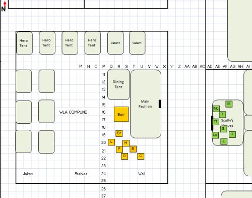
| 21:34, 2 March 2012 | WLACompoundMonth01.jpg (file) |  |
34 KB | W0ldianDM | WLA compound in Rum. Month on. | 1 |
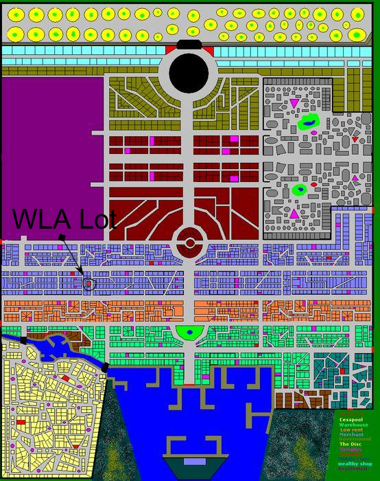
| 09:28, 27 January 2012 | RUMWLALotLocation.png (file) |  |
828 KB | W0ldianDM | Shows the location of the lot where the WLA will build their headquarters in Rum. | 1 |
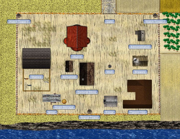
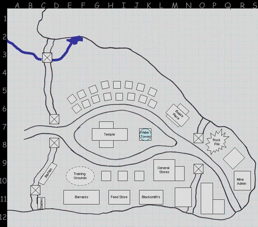
| 20:19, 26 January 2012 | Cthonia - Trading Post.JPG (file) |  |
155 KB | W0ldianDM | Map of the Cthonia Trading Post | 1 |
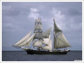
| 11:35, 13 December 2011 | Brahmah's ship The Courageous.jpg (file) |  |
9 KB | W0ldianDM | Ship owned by Brahmah of the Blackbird Lake Game | 1 |
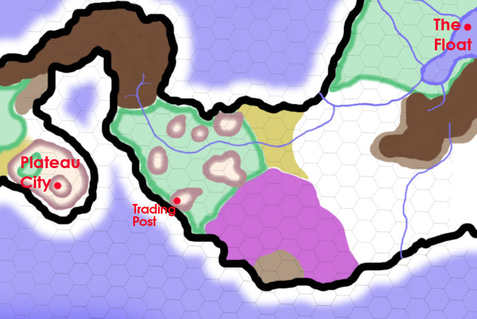
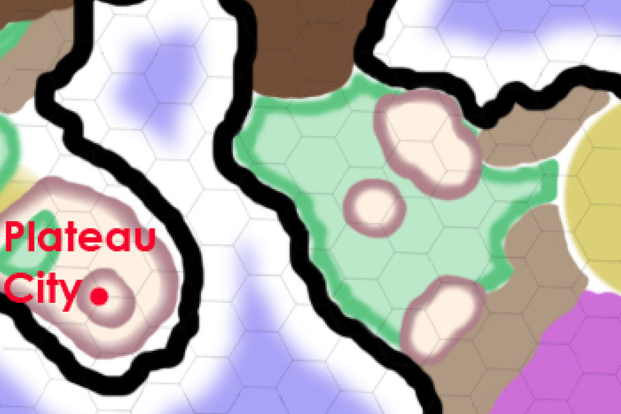
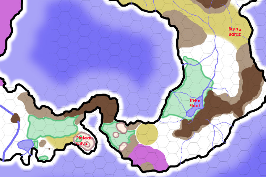
| 10:06, 8 July 2011 | SE-Yrth-3.jpg (file) |  |
66 KB | Cayzle | A map of the lands between Plateau City and The Floating City, on a 25-mile-per-hex scale. On this map, white = plains and prairie; puke-tan-green = broken badlands and ashen desert; light brown = hills; dark brown = mountains; and forest green = forest. | 1 |
| 10:05, 8 July 2011 | SE-Yrth-2.jpg (file) |  |
66 KB | Cayzle | A map of the lands between Plateau City and The Floating City, on a 25-mile-per-hex scale. On this map, white = plains and prairie; puke-tan-green = broken badlands and ashen desert; light brown = hills; dark brown = mountains; and forest green = forest. | 2 |
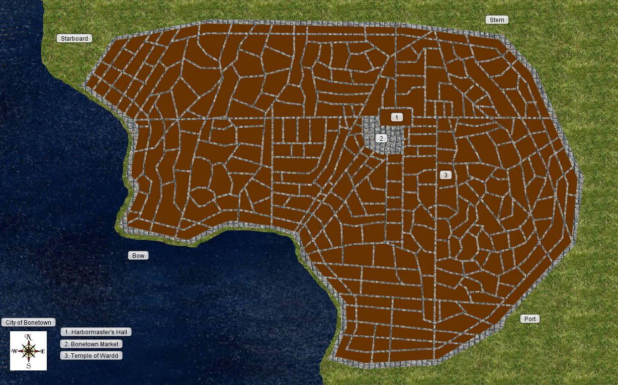
| 14:38, 15 June 2011 | NewRum.jpg (file) |  |
147 KB | W0ldianDM | The City of Rum | 1 |
| 14:24, 15 June 2011 | Rum2.JPG (file) |  |
96 KB | W0ldianDM | 1 | |
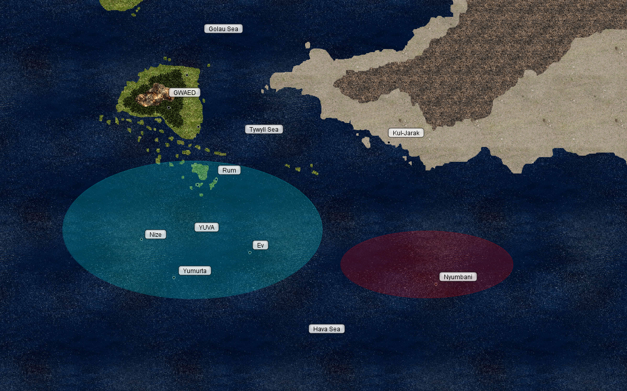
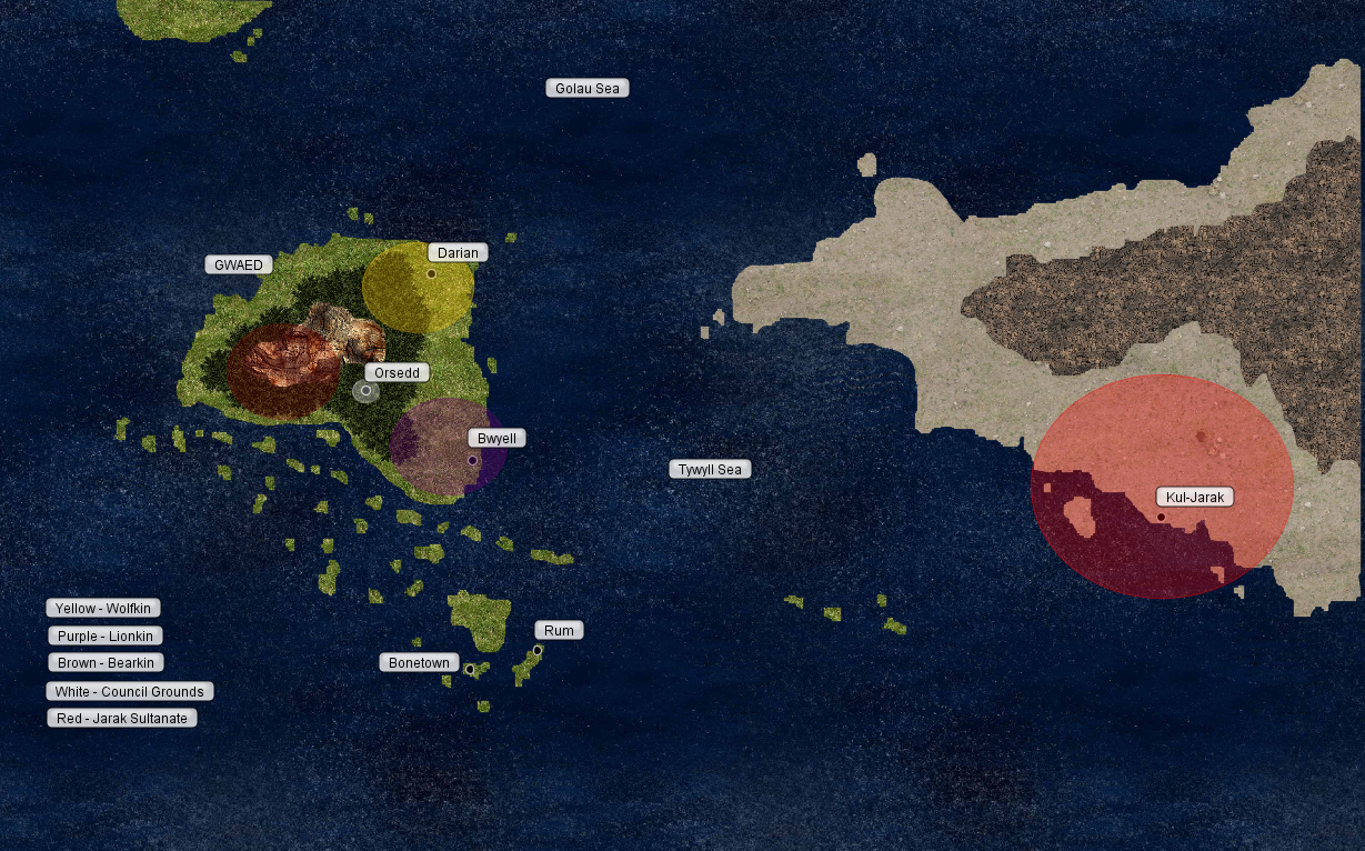
| 16:39, 8 June 2011 | BonetownSeaMap-Political.png (file) |  |
1.48 MB | W0ldianDM | 1 | |
| 16:38, 8 June 2011 | BonetownCampaignMap-Political.png (file) |  |
1.32 MB | W0ldianDM | 1 | |
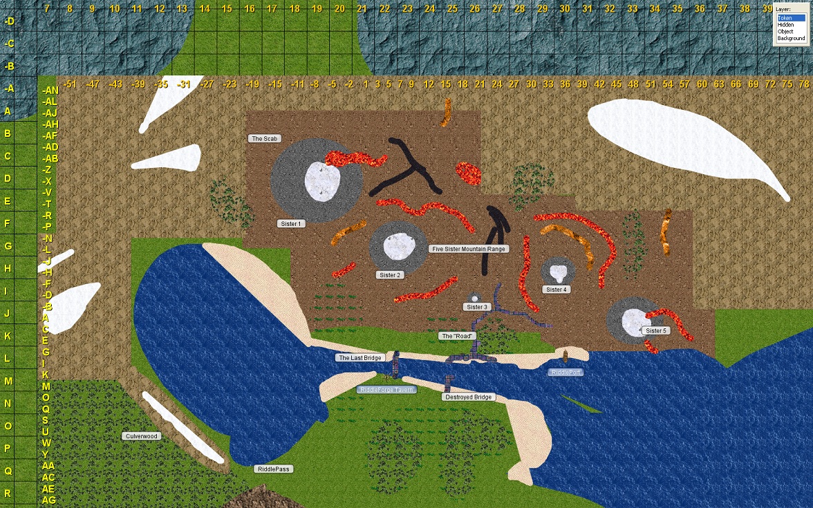
| 13:28, 2 June 2011 | The Scab Map 70.jpg (file) |  |
555 KB | W0ldianDM | 1 | |
| 23:49, 1 June 2011 | BonetownCityMap6-1-11.png (file) |  |
1.21 MB | W0ldianDM | 1 | |
| 17:36, 1 June 2011 | Tisbaga - Small.jpg (file) |  |
40 KB | W0ldianDM | I received permission from the artist to use this image for private, non-commercial use. | 1 |
| 16:53, 1 June 2011 | Nyumbani Symbol.jpg (file) |  |
5 KB | W0ldianDM | 1 | |
| 16:52, 1 June 2011 | Yuva Symbol.jpg (file) |  |
17 KB | W0ldianDM | 1 | |
| 16:32, 1 June 2011 | BonetownCampaignMapSeaPolitical.png (file) |  |
1.4 MB | W0ldianDM | 1 | |
| 16:31, 1 June 2011 | BonetownCampaignMapPolitical.png (file) |  |
1.32 MB | W0ldianDM | 1 | |
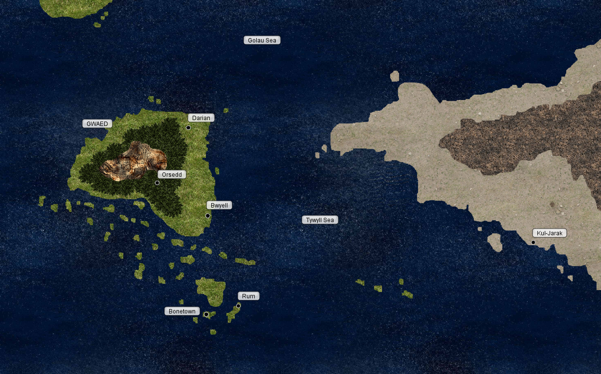
| 16:29, 1 June 2011 | BonetownCampaignMap.png (file) |  |
1.35 MB | W0ldianDM | 1 | |
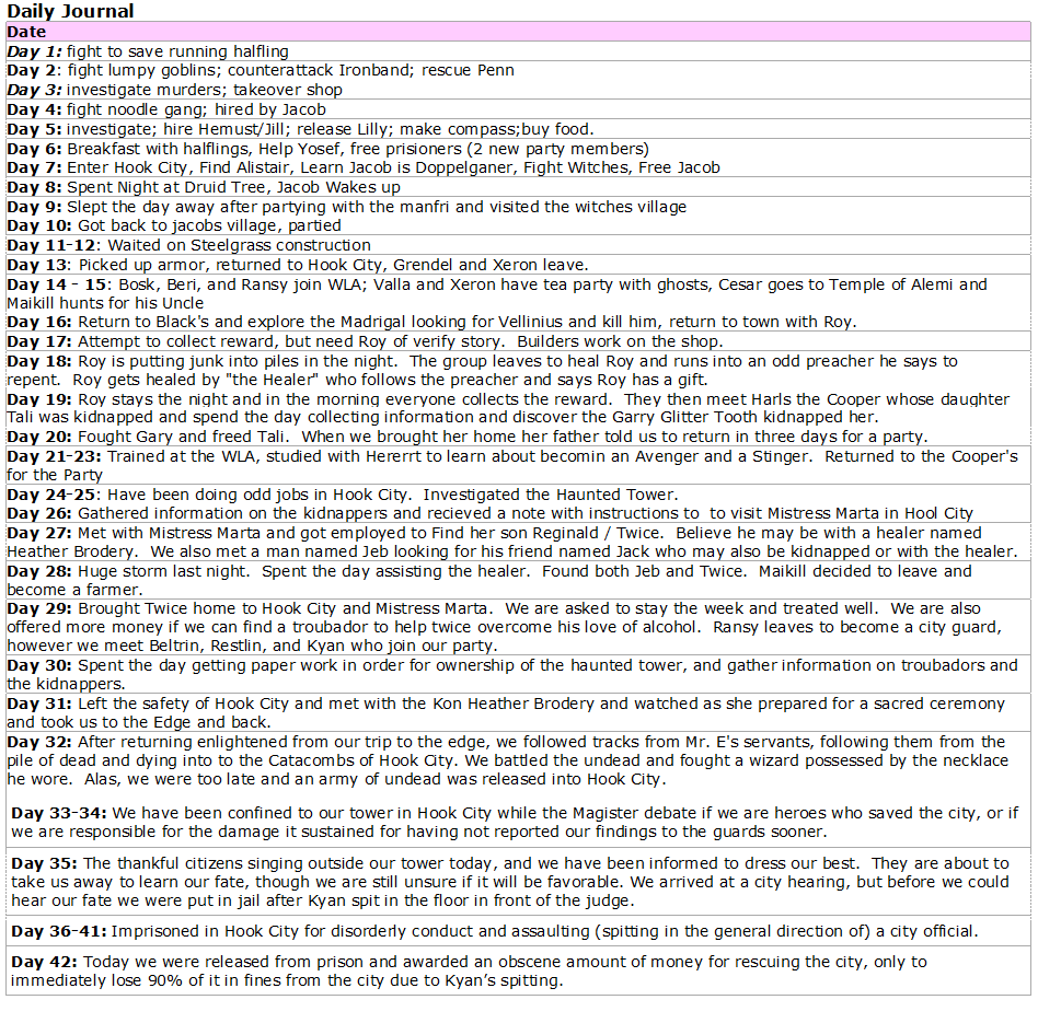
| 11:29, 31 May 2011 | Journal.png (file) |  |
118 KB | W0ldianDM | 2 | |
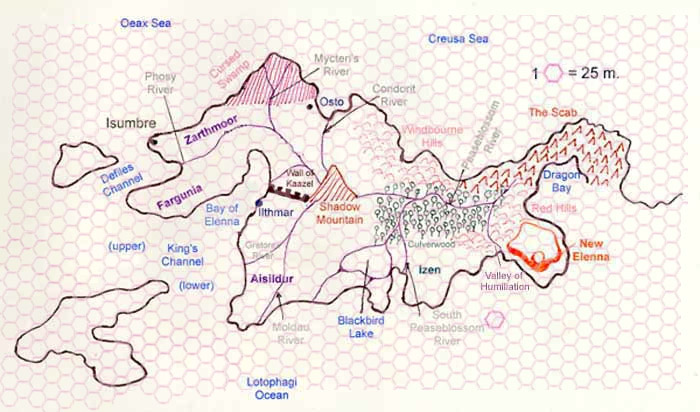
| 13:18, 20 May 2011 | Elennian-Peninsula.jpg (file) |  |
73 KB | Cayzle | This is a map of the Elennian Peninsula with a hex grid superimposed over it. One hex = 100 miles. | 1 |
| 14:20, 11 May 2011 | SE-Yrth-3b.jpg (file) |  |
76 KB | Cayzle | The wilderness south and east of the Scab. Each hex is 25 miles. | 1 |
| 14:19, 11 May 2011 | SE-Yrth-3a.jpg (file) |  |
75 KB | Cayzle | The wilderness south and east of the Scab. Each hex is 50 miles. | 1 |
| 14:17, 11 May 2011 | SE Yrth 1.jpg (file) |  |
107 KB | Cayzle | A map of the southeast corner of the continent of Yrth. Each hex is 50 miles. | 1 |
| 16:53, 19 April 2011 | Brynbarazmap.jpg (file) |  |
98 KB | Cayzle | A map of the new mining settlement at Bryn Baraz. | 1 |
| 04:28, 14 May 2010 | Hex Map of the Ellenian Peninsula.jpg (file) |  |
114 KB | Cayzle | This is a map of the Ellenian Peninsula with a hex grid overlaying it. The grid has a scale of 25 miles per hex. | 1 |
| 17:49, 7 April 2010 | Gatewaydownssmall.jpg (file) |  |
91 KB | Cayzle | A smaller map of the Gateway Downs | 1 |
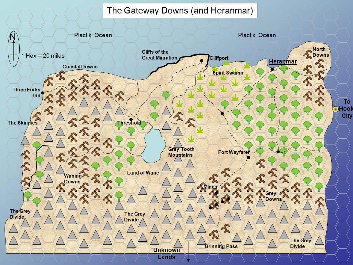
| 17:48, 7 April 2010 | Gatewaydowns.jpg (file) |  |
254 KB | Cayzle | A map of the Gateway Downs after the most recent Great Migration | 1 |
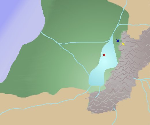
| 17:43, 10 December 2009 | CryingwoodsMap It-lal.jpg (file) |  |
18 KB | W0ldianDM | Map of It'lal location within CryingWoods. Yellow X is It'lal. Red X is the Float. Blue X is a Reptilans village and within a days trip to overgrown ruins. | 1 |
| 08:24, 17 November 2009 | BrynMap.jpg (file) |  |
105 KB | Cayzle | Map of Bryn Baraz. | 1 |
| 15:44, 8 October 2009 | MapNewGatewayDowns.jpg (file) |  |
231 KB | W0ldianDM | The Gateway Downs after the Great Migration. | 1 |
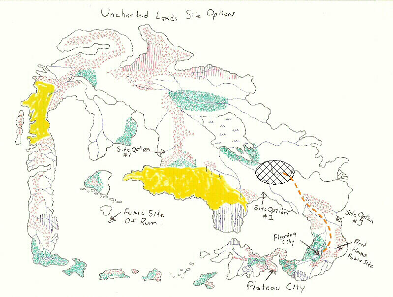
| 17:05, 21 September 2009 | UnchartedLands.jpg (file) |  |
123 KB | Cayzle | Uncharted Lands Initial Map showing possible settlement locations | 1 |
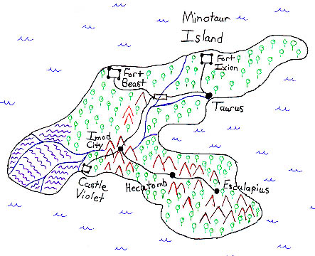
| 09:33, 19 June 2009 | MinotaurIsland.jpg (file) |  |
77 KB | Cayzle | A map of Minotaur Island. | 1 |
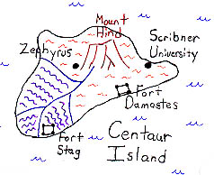
| 09:26, 19 June 2009 | CentaurIsland.jpg (file) |  |
43 KB | Cayzle | A map of Centaur Island. | 1 |
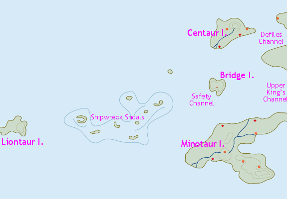
| 08:49, 19 June 2009 | Taurisles.gif (file) |  |
13 KB | Cayzle | A map of the Taur Isles. | 1 |
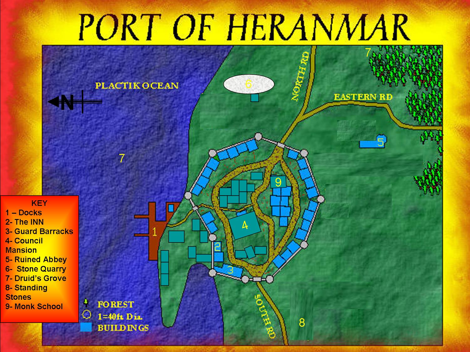
| 20:43, 23 April 2009 | Heranmar 2009.jpg (file) |  |
259 KB | W0ldianDM | 1 | |
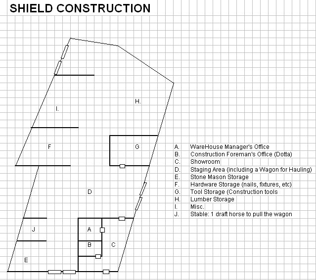
| 13:58, 20 April 2009 | ShieldConstruction.jpg (file) |  |
73 KB | W0ldianDM | Located on Fence Level just across from The Docks, this is the building which houses Shield Construction. Shield Construction is a joint partnership between the members of the Crimson Shields of Hope, Chairman, Syrdeth Redbow. | 1 |
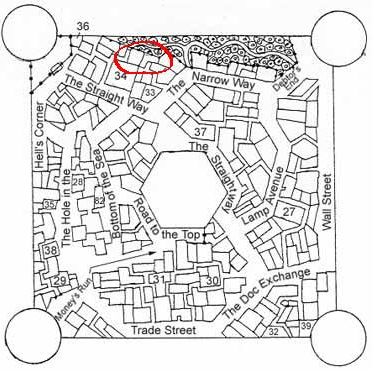
| 19:19, 13 April 2009 | MerchantLevelHome.JPG (file) |  |
41 KB | W0ldianDM | After the attack of the Crying Woods on Floating City during the Rising of the Fae King, the Crimson Shields found their old Apartments on Fence Level completely destroyed. They then bought their own place on Merchant Level, two adjacent plots with struc | 1 |
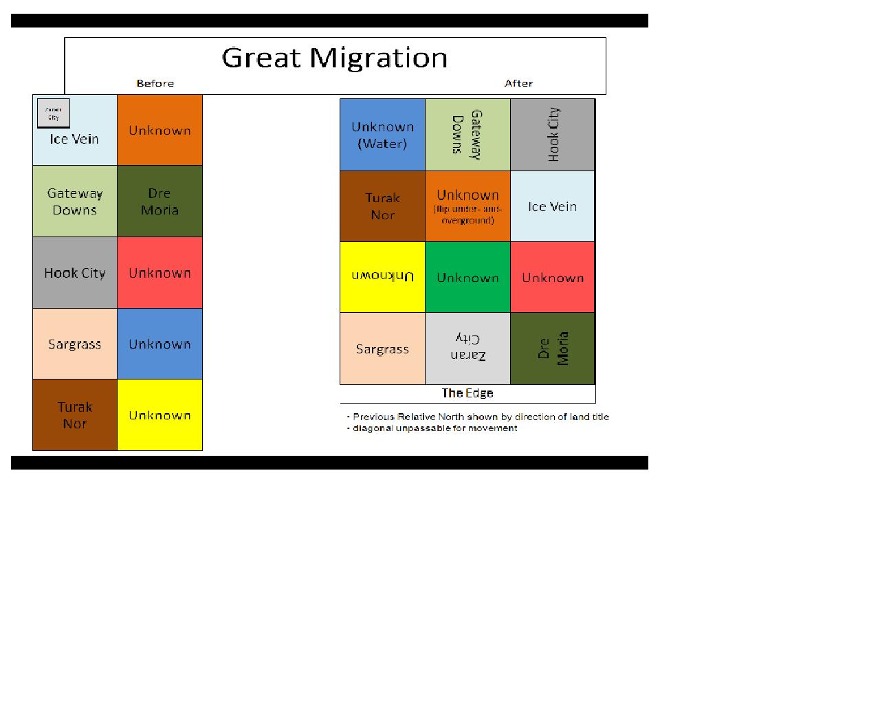
| 17:12, 25 March 2009 | 2009GreatMigration.JPG (file) |  |
77 KB | Cayzle | A map showing the before and after of the Great Migration. | 1 |
| 17:28, 1 February 2009 | It-lal 3D.jpg (file) |  |
47 KB | W0ldianDM | It-lal 3D image | 1 |
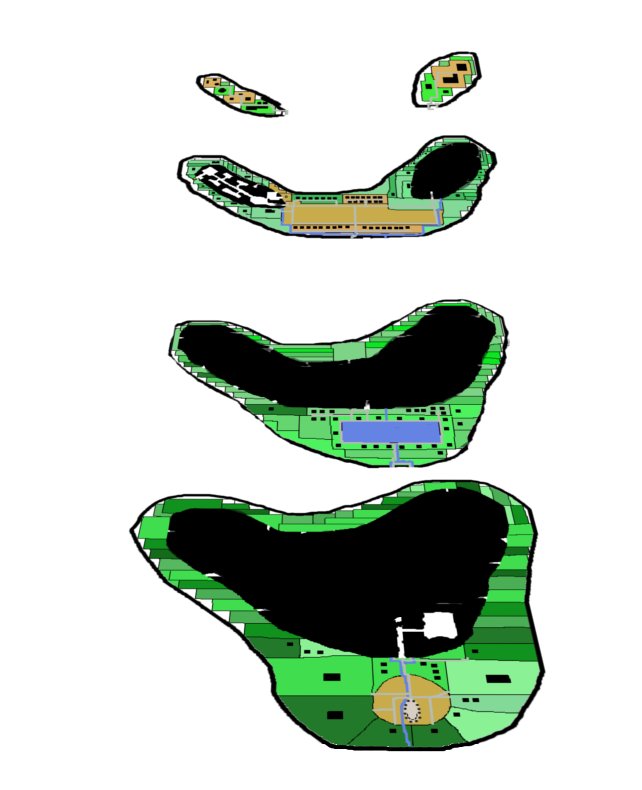
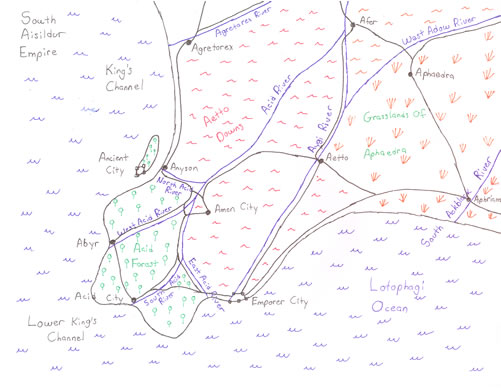
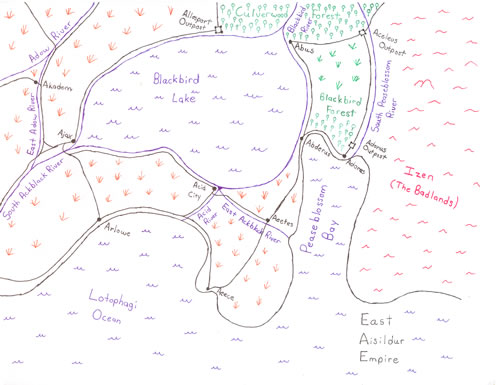
| 09:22, 16 January 2009 | Aisildur sw.jpg (file) |  |
42 KB | Cayzle | Southwest Aisildur | 1 |
| 09:21, 16 January 2009 | Aisildur se.jpg (file) |  |
40 KB | Cayzle | Southeast Aisildur | 1 |
First page |
Previous page |
Next page |
Last page |
