File:Float-BrynBaraz.jpg
From Woldipedia
Size of this preview: 800 × 568 pixels. Other resolution: 958 × 680 pixels.
Original file (958 × 680 pixels, file size: 80 KB, MIME type: image/jpeg)
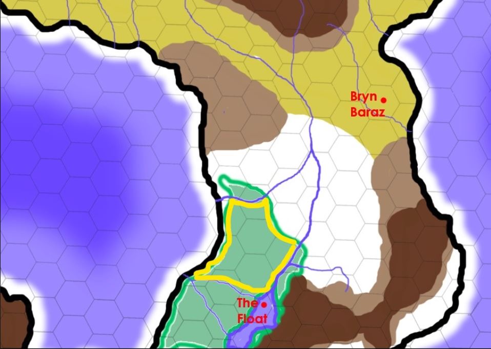
A map of The Crying Woods, the settlement at Bryn Baraz, and The Great Prairie that lies between them. On this map, white = plains and prairie; puke-tan-green (such as the area around Bryn Baraz) = broken badlands, scrub, and grasslands; light brown = hills; dark brown = mountains; and forest green = forest. The scale is 50 miles per hex.
During the Sargrass Crosssover (2018), the Crying Woods concentrated itself in the northwest quadrant of its former territory (outlined in yellow) and raised itself up onto an plateau. The escarpment on all sides of the Crying Woods is 50-70 feet high.
File history
Click on a date/time to view the file as it appeared at that time.
| Date/Time | Thumbnail | Dimensions | User | Comment | |
|---|---|---|---|---|---|
| current | 14:29, 7 January 2018 | | 958 × 680 (80 KB) | W0ldianDM (Talk | contribs) | Yellow outline highlights new boundary of Crying Woods. |
| 16:38, 19 April 2011 | 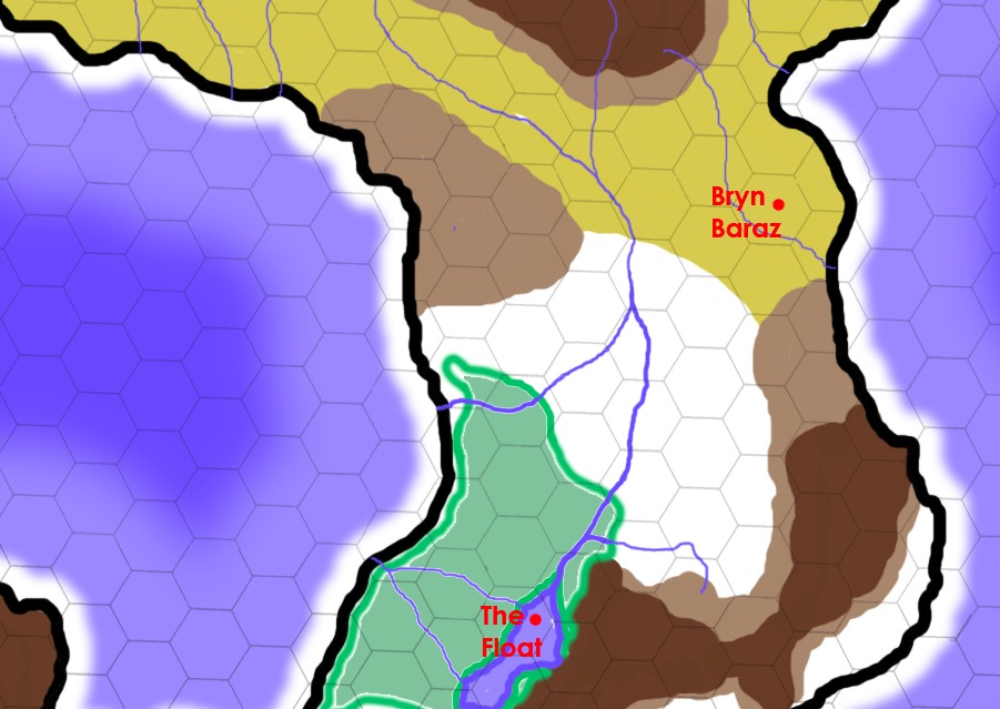 | 901 × 639 (114 KB) | Cayzle (Talk | contribs) | A map of The Crying Woods, the settlement at Bryn Baraz, and The Great Prairie that lies between them. On this map, white = plains, prairie; puke-green (such as the area around Bryn Baraz) = broken badlands, scrub, grasslands; light brown = hills; dark br |
- You cannot overwrite this file.
File usage
The following 3 pages link to this file:
