File:Southern-Yrth-8Apr12.jpg
From Woldipedia
Size of this preview: 800 × 281 pixels. Other resolution: 886 × 311 pixels.
Original file (886 × 311 pixels, file size: 125 KB, MIME type: image/jpeg)
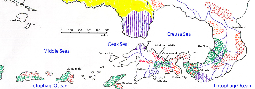
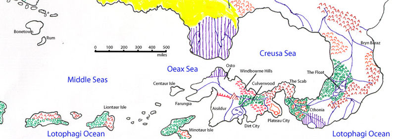
A map of the southern portion of the Continent of Yrth, showing those lands in which the civilization of New Elenna has spread, from Bonetown in the west to Brynn Baraz in the east. A scale showing miles in hundreds is included, with a selection of locations labelled.
File history
Click on a date/time to view the file as it appeared at that time.
| Date/Time | Thumbnail | Dimensions | User | Comment | |
|---|---|---|---|---|---|
| current | 05:51, 8 April 2012 | 886 × 311 (125 KB) | Cayzle (Talk | contribs) | A map of the southern portion of the Continent of Yrth, showing those lands in which the civilization of New Elenna has spread, from Bonetown in the west to Brynn Baraz in the east. A scale showing miles in hundreds is included, with a selection of locati |
- You cannot overwrite this file.
File usage
There are no pages that link to this file.
