File:SE-Yrth-3.jpg
From Woldipedia
No higher resolution available.
SE-Yrth-3.jpg (691 × 463 pixels, file size: 66 KB, MIME type: image/jpeg)
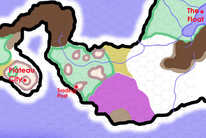
A map of the lands between Plateau City and The Floating City, on a 25-mile-per-hex scale. On this map, white = plains and prairie; puke-tan-green = broken badlands and ashen desert; light brown = hills; dark brown = mountains; purple = swamp and marsh; and forest green = forest. The mountains directly northeast of Plateau City is The Scab. The green jungle studded with plateaus and mesas next to The Scab is Cthonia. The forest around The Floating City is the Crying Woods.
File history
Click on a date/time to view the file as it appeared at that time.
| Date/Time | Thumbnail | Dimensions | User | Comment | |
|---|---|---|---|---|---|
| current | 10:06, 8 July 2011 | | 691 × 463 (66 KB) | Cayzle (Talk | contribs) | A map of the lands between Plateau City and The Floating City, on a 25-mile-per-hex scale. On this map, white = plains and prairie; puke-tan-green = broken badlands and ashen desert; light brown = hills; dark brown = mountains; and forest green = forest. |
- You cannot overwrite this file.
File usage
The following file is a duplicate of this file (more details):
The following 3 pages link to this file:
