File:SE-Yrth-2.jpg
From Woldipedia
No higher resolution available.
SE-Yrth-2.jpg (691 × 463 pixels, file size: 66 KB, MIME type: image/jpeg)
The southeast of the continent of Yrth. Each hex is 50 miles.
File history
Click on a date/time to view the file as it appeared at that time.
| Date/Time | Thumbnail | Dimensions | User | Comment | |
|---|---|---|---|---|---|
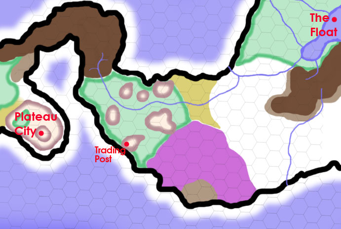
| current | 10:05, 8 July 2011 | | 691 × 463 (66 KB) | Cayzle (Talk | contribs) | A map of the lands between Plateau City and The Floating City, on a 25-mile-per-hex scale. On this map, white = plains and prairie; puke-tan-green = broken badlands and ashen desert; light brown = hills; dark brown = mountains; and forest green = forest. |
| 14:05, 11 May 2011 | 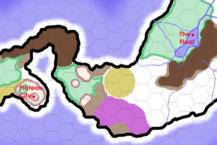 | 900 × 600 (87 KB) | Cayzle (Talk | contribs) | The southeast of the continent of Yrth. Each hex is 50 miles. |
- You cannot overwrite this file.
File usage
The following file is a duplicate of this file (more details):
There are no pages that link to this file.
