The Middle Seas
From Woldipedia
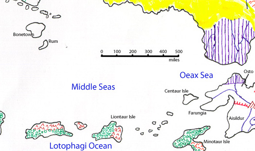
Here is an official Jerry-drawn map of the Middle Seas:
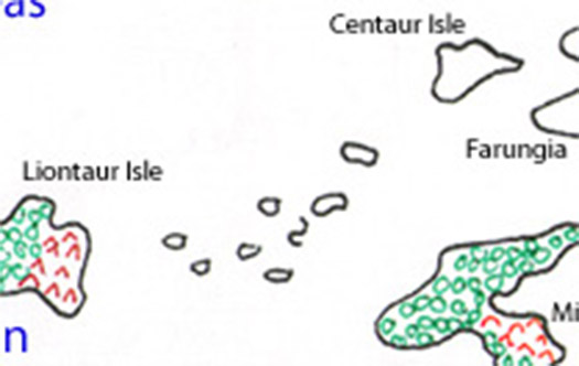
Let's zoom in on just the Taur Isles:
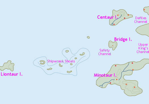
Here is a Cayzle redrawn map of the same area more or less:
If you super-impose them, what do you see? Cayzle's version of Liontaur Isle is much smaller than Jerry's. Food for thought.
The Middle Seas are the mostly unexplored waters to the north and northwest of the Taur Isles. They stretch from Farungia and Aisildur in the east to Rum and Bonetown -- and beyond -- in the far west. Not shown on this map are the undiscovered and unknown islands and archipelagos that dot the vast seas of this region.
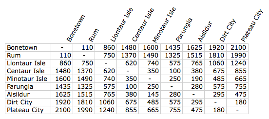
Typical travel distances in miles by ship across the Middle Seas:
Notes
- The distances to Minotaur Isle assume a destination of Taurus.
- The distances to Aisildur assume a destination of Emperor City in the southwest of the country.
- The distances to Farungia assume a destination of Wedding City.
- The distances between New Elenna and the Rum area assume transit through Chessford on Liontaur Isle. There is a shorter, but more treacherous and stormy route, that sails a straight path from Centaur Isle to Rum, which can cut 330 miles off the trip. Most ship captains deem the route too dangerous.
- The distances above assume travel between Liontaur and Minotaur Isles along the northern edge of Minotaur Isle. There is a southern route as well, but that adds 60 miles to the distance, and is used usually by those seeking to skirt the Shipwreck Shoals, and by those wishing to make a stop along the way at Castle Violet, on the southern shore of Minotaur Isle. Castle Violet is the closest port to Imod City, the capitol. Note that a direct route between Chessford (Velawia, in the wemic tongue) and Fort Beast, on the northwest shore of Minotaur Isle, is only 485 miles.


